MICHAEL's EMAIL

WELCOME TO THE MICHAEL J MORRIS REPORT!!!!

EMAIL mj.morris@live.ca

WRITE ME WITH COMMENTS, STORY IDEAS, SUGGESTIONS, INFORMATION REQUESTS. IF YOU CAN'T FIND A STORY, DO NOT HESITATE TO EMAIL ME

Showing posts with label hudson bay company. Show all posts

Saturday, January 28, 2017

Early Tourism in the Chapleau Region: The 1905 Canoe Trip Of Dr. Howard A. Kelly

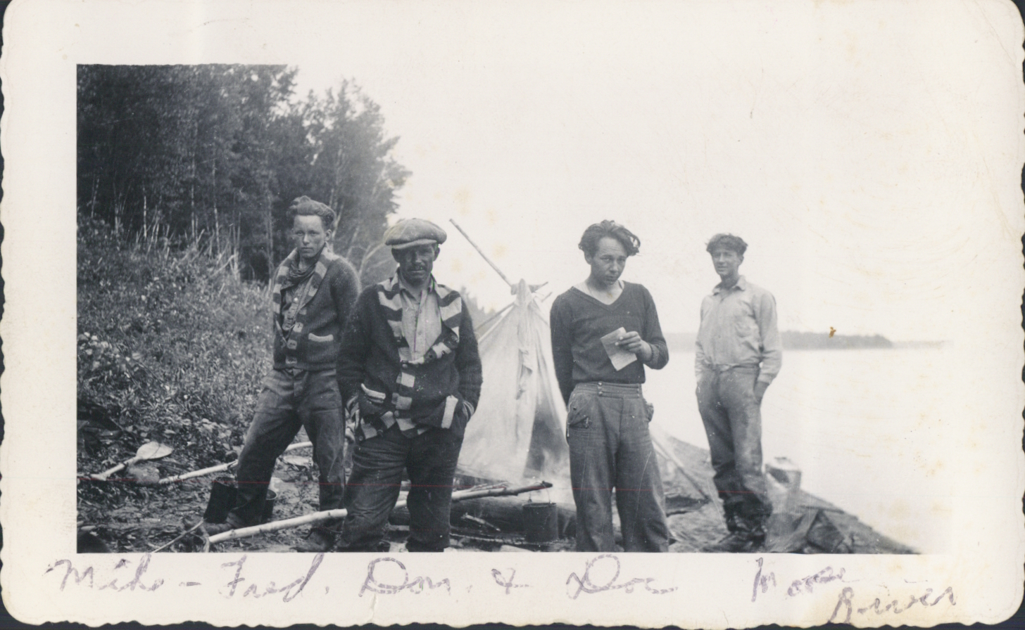
1 Canoe Trip Staging Area at Old CPR Winnebago Siding (1905) Dr. Howard Kelly

Note --- Thanks to Ian and Mike for their articles on some of the early history of the Chapleau region. This is the final one in the series for the moment. Much appreciated that they had them set to go while I was in Orlando -- enjoying my longest stay ever there. I am back in Cranbrook now.My email is mj.morris@live.ca  MJM

By Ian Macdonald and Mike McMullen 

We normally associate American tourism in Chapleau with the opening of Highway 129 in 1949 when vehicles with licence plates from the northern United States gradually began to appear on Chapleau streets. The fact is that the challenge of exploring the remote Northern Ontario wilderness had attracted visitors from the United States long before that time.

The year is 1905. The natural and undisturbed wilderness of the Laurentian shield remains much as it has been for the past century.  It would be another five years until Olie Evinrude’s newly invented outboard motor would violate the pristine solitude of this country and challenge the canoe as the prime mode of wilderness travel. It would be a further 10 years until the Ontario Provincial Air Service would introduce Northern Ontario to the first amphibious aircraft in 1919.

Chapleau in 1905 is just approaching the end of the first wave of building associated with construction of the Canadian Pacific Railway (CPR) and will wait yet another four years until the village is introduced to electricity in 1909. Early negotiations leading to the creation of Treaty 9 (James Bay Treaty) with the Cree Nation have just begun. A land surveyor from Little Current, Ontario by the name of T.J. Patten has submitted an official land survey of a 220 acre parcel of land, which includes the site of an abandoned HBC sub post, a mile south of Chapleau, which becomes Indian Reserve (I.R.) 61 for the Michipicoten Ojibwe.

1905 was also an important year for Dr. Howard A. Kelly of Baltimore, Maryland, who along with two sons, two nephews, a professional colleague and his son, planned an 18-day journey in the Canadian wilderness travelling by canoe from the height of land near present day Sultan, south to the Mississagi River and from there to where it empties into Lake Huron at Blind River, Ontario. For the children, it must have been the trip of a lifetime.

Dr. Kelly had already acquired property at Ahmic Lake near Burk’s Falls in the early 1890s, which is where this trip originated. He joined Dr.Angell at his summer camp near Restoule, boarded the steamer which crossed Lake Nipissing to North Bay, where they caught a westbound CPR passenger train. They likely met up with their guides in Biscotasing. The Mississagi River can be reached from Biscotasing, but Dr. Kelly opted to travel further west up the CPR to a railway siding named Winnebago where the CPR crosses the Wakami River approximately 43 miles east of Chapleau (Photo 1).

Lumbering activity had not yet begun in the Wakami region in 1905 and the future village of Sultan did not yet exist. This was still classic unspoiled Laurentian Shield country and Dr. Kelly would be one of the first American visitors to attempt such a journey. At the end of their journey they would have caught a CPR train at Blind River for their return to the east.
 
It is most fortunate for us that he brought a camera with him and recorded the trip with photographs cross referenced to a meticulous detailed diary of the journey. Besides the journey, it provides us with a rare record of traditional Ojibwe culture in the Chapleau region that was rapidly disappearing.

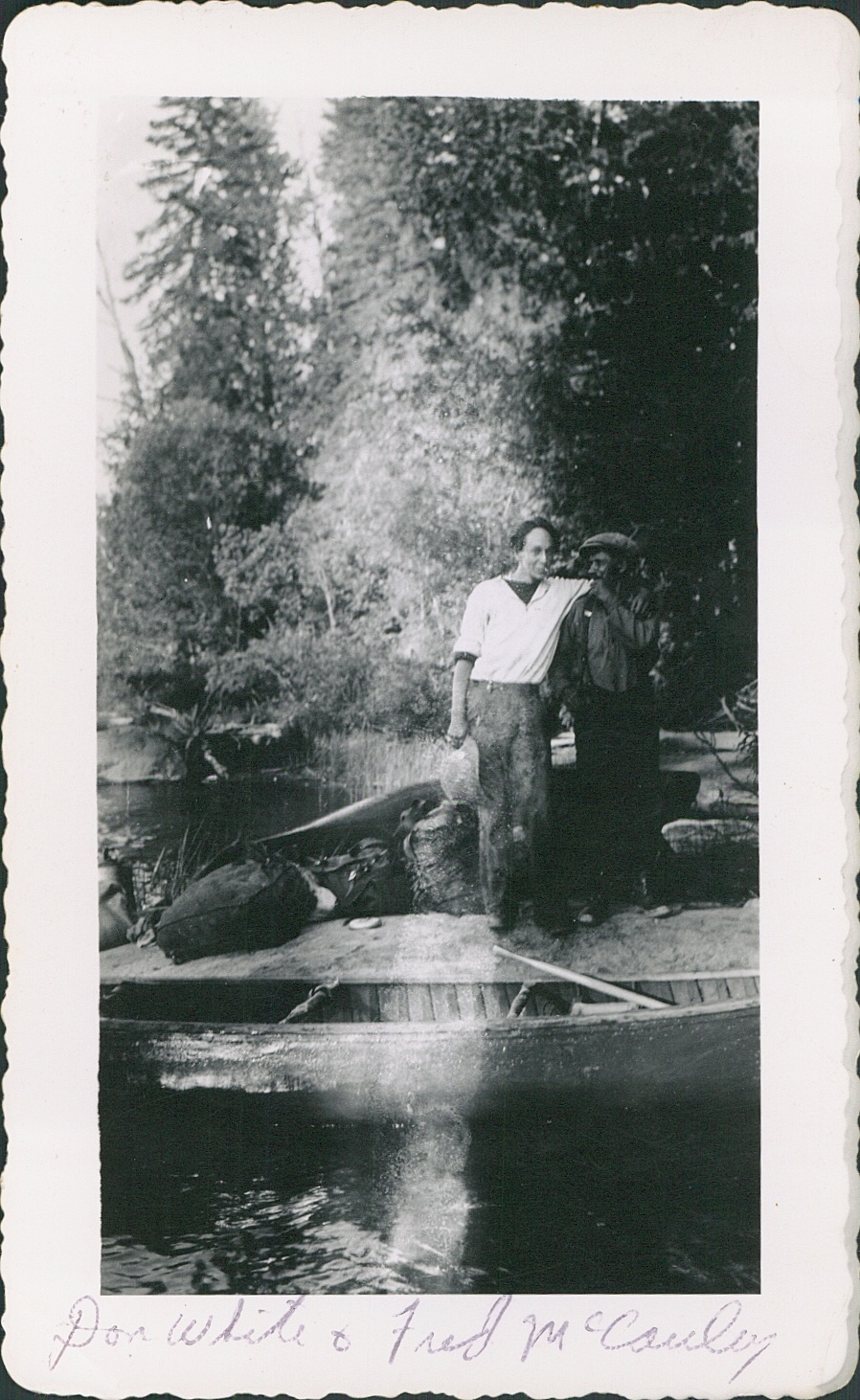
According to Dr. Kelly’s great grandson, Steve Davis, “As far as I can tell, there were twelve people for 18 days on the trip. These were: Dr. Howard A. Kelly, age 47 and two of his sons, Henry (age 12) and Fritz (age 10) and his two nephews (children of his sister Dora) Bob Lewis (age 19), Shippen Lewis (age 18), and a Dr. Angell, and Montg, who is Dr. Angell's son, Montgomery (age 16) and guides, Phillipe, Octave, Tom, Ian, and Jim who may have been a ranger who was only with them a few days. The guide, Tom appears to have been the guide-in-charge. There seems to have been 5 canoes, one a Peterborough, one an Old Town, the rest unknown.”

The Wakami River is approximately 1440 feet above sea level where it flows under the CPR tracks at the old Winnebago siding. This canoe journey of probably over 150 miles will descend 840 feet through a network of rivers, lakes, rapids, waterfalls and numerous portages through the Mississagi River system to Blind River on Lake Huron. The canoe route taken by Dr. Kelly’s party in September 1905 began at Winnebago Siding, up the Wakami River to Wakami Lake, portaging over the height of land from Wakami Lake into Kebskwasheshi Lake and down the Kebskwasheshi River into the Wenebegon River. The Wenebegon River eventually joins the Mississagi River near Aubrey Falls (Photo 2).
2 Aubrey Falls, Mississagi River (1905) Dr. Howard Kelly

A similar trip today would take 13 or 14 days, cover about 155 miles with 18 portages. The reservoirs created by the large hydroelectric dams at Aubrey Falls and Wharncliffe have significantly impacted the original topography of the Wenebegon and Mississagi Rivers existing at the time of the 1905 canoe trip and submerged many of the distinctive geographic features documented by Dr. Kelly.

During this trip, Dr. Kelly encounters a number of Ojibwe families and settlements, which he photographs and describes in his extraordinary journal. (Photo 3). His documentation of the journey reflects a genuine interest and sensitivity to native culture, is specific and at the same time poetic. His writing reflects professional attention to detail and his respect for Ojibwe property is evident as the group explores abdandoned Ojibwe encampments. The following two entries from his diary describe general observations of Ojibwe settlements and of items at a site where recent canoe making has evidently taken place. (Photo 4)

Ojibwe Settlements

“Camped Wednesday night in an Indian camp on the left of the entrance of the river from Round Lake. These Indian camps show many interesting details of Indian lives. The character of their dwellings, large tepees, double lean-tos, cooking arrangements are 3 poles with hooks of alder. Dog house, arrangements for smoking hides, arrangements for smoking meat, arrangements for fleshing hides, for tacking out bearskins.”
3 Henry and Fritz Kelly with Ojibwe Family near Wenebegon River (1905) Dr. Howard Kelly
Canoe Making and Other Items

“ Carpentering 
making canoes 
numerous frames
slats for sides
cross pieces 
birch bank in rolls covered well  
stakes of cedar for holding the canoe in place 
shavings from the draw knife all over the place, bushels and bushels of them
papoose holder 
float sticks for nets  
stones on shore tied with spruce roots for sinking nets 
numerous bundles of long strips of spruce roots tied up 
numerous birch bark receptacles of all sizes  holding from a bushel to a quart made of one piece tied with root
Cedar brush (flat) for a flat surface
Cedar brush round form for scrubbing”


4 Ojibwe Canoe Framing (1905) Dr. Howard Kelly
Dr. Kelly has provided an extensive detailed record of his journey down the Mississagi and we have been able to provide only a brief synopsis of his journey in this article.  We plan to do detailed research into much of the material covered in his diary for future publication.   We are fortunate that Dr. Kelly has provided descriptions and rare insight of what can be best characterized as the cultural landscape of the Mississagi River system that remains a significant part of the cultural heritage of the Chapleau region.

Dr. Howard A. Kelly
Dr. Howard A. Kelly was an internationally renowned surgeon and medical pioneer, medical educator and author. He is the founder of Kensington Hospital in Philadelphia and one of the “Big Four” founding professors at the world famous Johns Hopkins Hospital in Baltimore, Maryland.
All photographs in this article are the property of the Kelly family.  Dr. Kelly’s original journal has been donated to and is in the hands of the Chesney Medical Archives of Hopkins.

We are especially grateful to Dr. Kelly’s great grandson, Mr. Dave Davis, who initiated contact with us and generously made this rare material available for our use. We are equally grateful to Mr. Woollcott Kelly, grandson and family historian of Dr. Kelly, who gave us permission to publish this material.

We also acknowledge the assistance of Professor Niigaanwewidam James Sinclair, Head of the Department of Native Studies, University of Manitoba and Professor Jacqueline Romanow, Department  Chair, Department of Indigenous Studies, University of Winnipeg for their expert comment and advice.

Saturday, January 14, 2017

Michipicoten Ojibwe: A Permanent Home at Chapleau


Ojibwe families at HBC Sub Post (1884) CP Archives and Ian Macdonald 
Based on ongoing research, Mike McMullen and Ian Macdonald have prepared  a series of three articles relating to early Chapleau history. Here is the first: 'Michipicoten Ojibwe: A Permanent Home at Chapleau'. I extend my sincere thanks to Mike and Ian for having these articles ready for while I am in Orlando on one of my periodic visits. My email is mj.morris@live.ca


By Mike McMullen and Ian Macdonald
In a letter dated September 1, 1903, William L. Nichols, Indian Agent located in Sault Ste. Marie, wrote to the Department of Indian Affairs in Ottawa outlining a request on behalf of 16 adult male members of the Ojibwe group living at or near the village of Chapleau. They desired that a small portion of land be acquired for them in this area as this was where they obtained most of their livelihood.  The sixteen, representing a total of 52 family members, wanted to establish permanent homes for their families and cultivate small plots of land. Furthermore, they were prepared to pay for this land out of their Robinson-Superior Treaty annuities.  

The names of the 16 Ojibwe who made this request for land, with the total family units in brackets, were:

Chessewahninie, Simon Sr. (1+1=2)
Quemzause   (1+3=4)
Manawassin, John  (1+1=2)
Penewajisik   (1+2=3)
Kebekmaise, Peter  (1+5=6)
Manawassin   (1+1=2)
Chessewahninie, Simon Jr. (1+2=3)
Ashtijizik   (1+2=3)
Caudissa, Jacob   (1+2=3)
Maymayguess, Moses  (1+2=3)
Johnston, John   (1+4=5)
Maymayguess, Joseph  (1+2=3)
Caudissa, Joseph  (1+1=2)
Maymayguess, Ignatious (1+3=4)
Manawassin, Peter  (1+2=3)
Okeemahbinasie or Grosse Jambetta  (1+3=4)

The 52 persons represented on this list were on the Michipicoten pay list of the Robinson-Superior Treaty. The annuity at this time was $4.00 per person per year.

These Ojibwe were part of the Michipicoten Ojibwe Band (also referred to as Robinson Treaty Indians) located near Michipicoten Harbour on eastern Lake Superior, but were a separate inland group or branch of the band.  They tended to camp in the interior near Chapleau, where they hunted, fished and trapped on both sides of the nearby height of land. They would travel back to the Michipicoten River area to trade furs at the Hudson’s Bay Company (HBC) Michipicoten post.  Another inland branch of the Michipicoten Ojibwe Band was located near the village of Missanabie (Missinaibi). 

In the fall of 1884, a Canadian Pacific Railway (CPR) survey crew came to a site on the east side of the Nebskwashi River where a three-building HBC sub post was being built. The southeast boundary marker of the town site for the future village of Chapleau would be located nearby.  One of the photographs taken that day shows a group of indigenous people with their teepees (Photo 1). We believe that they were members of the Michipicoten Ojibwe inland group that some 19 years later would make representations in September 1903 with Indian Agent Nichols for a parcel of land at Chapleau.  

With the completion of this HBC Chapleau sub post in late 1884, we believe that the Michipicoten Ojibwe group began to stay in the Chapleau area for most of the year. Carrying out their traditional activities, they were able to trade their furs with HBC at Chapleau without having to go specifically to Michipicoten.  There were increasing opportunities for work in the local regional Chapleau economy. These included working in the bush doing such activities as guiding, tree cutting and survey line cutting. At Chapleau, there would have been general labourer activities associated with the CPR and the growing village.   Also, by early 1887, there were merchants now located in Chapleau providing competition to HBC for their furs. Perhaps, these Michipicoten Ojibwe realized that their future now depended upon living in the Chapleau area and this required a permanent settlement on land of their own.

The Nichols letter of September 1903 clearly received a favourable response as correspondence showed that the decision to begin the process for granting this Ojibwe request was made within a month of receiving it. Then in October, Indian Affairs informed the Ontario Department of Crown Lands of its intention to purchase land at Chapleau on behalf of the Michipicoten Ojibwe group.  Ontario Crown Lands was agreeable subject to an evaluation of any lands in question and a survey.
Perhaps, as a requirement of the process, Nichols, in July 1904, prepared a more formal petition addressed to the Dominion of Canada on behalf of the Michipicoten Ojibwe group.  A hand-written document, dated July 20, 1904, with 16 names and witnessed signatures (they signed with Xs), outlined their reasons for wanting land at Chapleau. The group identified themselves as members of the Michipicoten Band, and had just met in Council at Chapleau under local chief Chessewahninie (Simon Sr.) for the purposes of this petition. They requested that land be “set apart for own use and the use of our families while we are absent on voyaging trips or in other work so that we could build small buildings which we could use from year to year.”  They wanted it situated near Chapleau so “our children and wives could attend school & church.” In follow-up correspondence, Nichols indicated that the group was currently camping on CPR lands and was concerned about being ordered off at any time. It is evident that Nichols was sympathetic to their situation and wanted a land transaction completed for them as soon as possible.

Shortly after submitting the petition, Nichols suggested land on the east side of the Nebskwashi River, southeast of Chapleau, which he estimated at about 160 acres. He wrote that on this property “the Hudson Bay had a temporary post, but it has all gone to decay” (the sub post constructed in late 1884). Indian Affairs accepted his selection of land for the Michipicoten Ojibwe group.  A review and evaluation  by Ontario Crown Lands in October determined that this land was not subject to any prior claims, was of little value and the timber was only of use for firewood.  Shortly thereafter, arrangements were then made for a survey of the property, which was completed in November 1904 with the official survey submitted in early 1905. The size of the surveyed property was 220 acres.
The land transaction was completed in 1905. In May, Indian Affairs purchased the 220 acre property ($1.00/acre) from Ontario Crown Lands in trust for the Michipicoten Ojibwe group at Chapleau. An Ontario Order-In-Council, dated October 18, 1905, confirmed the transaction.  The property was transferred to the Michipicoten Ojibwe Band and designated as Indian Reserve (I.R.) 61.

The purchase of this reserve by the band was paid out of its general funds and reimbursed over time by the Michipicoten Ojibwe group at Chapleau out of their Robinson Treaty annuities
This Michipicoten Ojibwe group now had their land and the opportunity to build their own settlement close to the village of Chapleau.  We believe that they would have quickly made efforts to salvage and restore the three HBC buildings on their property before constructing additional structures to house their members. They apparently made noticeable progress in a short period of time. The Treaty 9 Commissioners, who were in Chapleau in July 1906, wrote at that time that the land purchased by the Robinson Treaty Indians (I.R. 61) “has already been substantially improved.”  Over time this settlement became commonly known in the area as the Memegos (Maymayguess) site. 

In 1906, a picture was taken of Chief Chessequinn (Chessewahninie) being painted by portrait artist Edmund Morris.  Morris was accompanying the Treaty Commissioners negotiating Treaty 9. The location would have been at the Memegos site with the Nebskwashi River in the near background and the CPR line in the far background along the far shore.
The Painting of Chief Cheesequin (1906) Library and Archives Canada 


A 1924 photograph of the site, taken from across the River on the CPR line, shows about 7-8 buildings and maybe there were more. At some point in time, there were two small churches at this site: one Anglican and one Roman Catholic.
Memegos Site on I.R. 61 on east bank of Nebskwashi River (1924) Vince Crichton  collection

However, by late 1965, only 14 Ojibwe lived on the site with 13 of them being Memegos family members. About 1970, the site was abandoned as a new settlement south of Chapleau, off Highway 129 on I.R. 74A, was established.
On the Memegos Site on east bank of Nebskwashi River (2014) Mike McMullen


We visited the Memegos site in May 2013 and partial remains of three buildings were the only reminder of the first permanent site of the Michipicoten Ojibwe at Chapleau.


Saturday, April 2, 2016

Living in 'grand old days' of Chapleau after CPR arrived in boxcars and tents during 1885-86

Photo credit below
Looking back at Chapleau's early days in 1885-86, after the arrival of the Canadian Pacific Railway, an unidentified writer of several articles included in the Richard Brownlee Papers, talks about Old and New Chapleau which seem to have had little contact with each other.

Apparently written in 1935 to mark the 50th anniversary of the community (not the incorporation of Chapleau as a municipality in 1901), the writer refers to the time  as "those grand old days".

"Old Chapleau was on the hill but a few company houses were built for the employees near the railway." There were also some boxcars.

At first read I could not figure out where the hill was, then recalled that Mr. Brownlee's first barber shop was in a tent on the hill near where the Lady Minto Hospital was built at Elm and Queen Streets.

The writer noted that the "first time a small group of people went to view where the (Roman Catholic) church was to be built ... they thought they would never get there. It was a long tedious tramp through the bush (to where Collins furniture store at Birch and Lorne Streets is now). They were living in tents in Old Chapleau.

Also, at this time they were "doing most of their shopping at the Hudson's Bay store" which was then located at what is now commonly referred to as the Memegos Property near the intersection of Highway 101 to Timmins, and Highway 129.

This meant that during the winter of 1885-86. those living in Old Chapleau would walk on present Elm. but a trail through the bush then,  to the CPR tracks, and along them, then crossed the Nebskwashi River to the Hudson's Bay store, and then back home. Amazing.

There has been some dispute by Chapleau researchers over the years about where the Hudson's Bay store was actually located before being relocated into the community, but this article, adds more credibility to the work done by Michael McMullen and Ian Macdonald. They placed it on the Memegos Property. Both Ian and Michael have also written about Chapleau's early years.


Also interestingly, the article notes: "Strange as it may seem, the young people living in company houses seldom went tp Chapleau on the hill, as they were barely acquainted with the residents up there."

Turning to "New Chapleau" the article notes that at the same time, some of the first settlers lived in tents located at about where the old overhead bridge was located, while others lived in two rows of boxcars -- on streets called Godin Avenue and Stovepipe Avenue.

Meanwhile, as I wrote in my 1984 book 'Sons of Thunder ... Apostles of Love' the history of St. John's Anglican Church, by the end of 1885, the CPR had built a roundhouse with turntable, and a water tank. The first station was in a boxcar but one was under construction. "Chapleau had become a town made up of surplus boxcars and tents. The population consisted of about 400 people, ninety-five percent of them men."

I also wrote that the winter of 1885 was very strenuous for the early citizens of the fledgling community. They had left their old way of life to build a new one far from any comforts they might have known. It was apparently a very cold winter and disease was rampant.

Yet, despite the obstacles, folks in Old and New Chapleau came together and created a thriving community very quickly. Just imagine, if you will, early citizens like J.T. Serre, Richard Brownlee and others would also party at the Hudson's Bay store on the Memegos Property walking there and back. 

Amazing people. Again my thanks to Margaret Rose (Payette) and Bobby Fortin, who by the way are both members of Chapleau pioneer families. for loaning me the Richard Brownlee papers. Thanks as well to Ian and Michael for their research. My email is mj.morris@live.ca

Photo credit  

          HBC Chapleau Outpost under Construction (1884) CP Archives and Ian Macdonald


Wednesday, July 31, 2013

Six young Chapleau adventurers make trip to Moose Factory mostly by canoe in 1932

Six adventurers made a canoe trip from Chapleau to Moose Factory in July 1932 recording their progress in writing as they travelled. Their chronological account was kindly made available to me by Dorothy Turner, and I am delighted to share parts of it as the Chapleau Cree First Nation hold their annual Traditional Gathering and Pow-Wow on August 17 and 18.

The young men were Donald White, Oliver 'Doc' Potts, Howard Cachagee, Mike Turner, Fred McAuley and Vince Crichton. In 1968, Vince typed out an account of the trip from the notes and sent it to Mike Turner, Dorothy's uncle, with the following comment written on the top of the first page: "Mike. I hope I have recorded this properly. Vince".
Mike Turner, Fred McAuley, Don White, Doc Potts


They left Chapleau on July 1, 1932, by train for Missanabie with two canoes and all their equipment. "We arrived at Missanabie about 8;30 p.m. and immediately started on the first lap of our canoe journey. We camped a couple of miles north of the railroad track... After a late supper we sat around the camp fire, telling stories, as the fuel turned into dying, glowing embers. The night was clear and cold and after making our canoes and provisions safe from marauding animals we turned in with high expectations of the morrow."

"Shortly after sun up the next morning we were having breakfast of bacon and eggs. The aroma of the repast with the boiling coffee whetted our desire for the adventure and it was not long before we were on our way. Loading up our big freight canoes with equipment and three men to a canoe, we were content to let a small three horsepower engine do most of the work for the first day.
Howard Cachagee, Vince Crichton, Don White

"The night had been cold and frosty. The surface of the lake was like a sheet of glass and covered with millions of mosquitoes, presumably killed by the frost of the previous night.

After a seven mile run up Dog Lake, they portaged to Crooked Lake a distance of about 150 yards. "All along Crooked Lake we saw moose and bear and in almost every bay either a live of dead beaver house."

At the end of the lake they made another portage over the height of land to Missinaibi Lake. This height of land separates the waters flowing into Lake superior from those flowing into James and Hudson Bay.
Don White, Mike Turner, Doc Potts

Upon reaching Baltic Bay they took a route to the northeaast arm arriving at a long peninsula varying in width to three miles.

"It terminates abruptly in a granite cliff, towering in places to well over two hundred feet. This is known as Fairy Point. Many years ago, the Cree and Ojibway banded together for self protection from bands of Iroquois and drove an armed band over the cliffs to complete destruction. Looking closely at the cliffs one can discern Indian pictographs of centuries ago which only time can eliminate."

They arrived at Brunswick House to explore the remains of the once thriving Hudson Bay Company Post. They note that most of the buildings were in ruins but some still some were standing, the remains of an old boat were on the shore and along the beach and in the ruins were old rifles and flintlocks with the stocks nearly eroded completely away.

They also visited a cemetery to which pilgrimages were still made "every few years to keep the hallowed spot of their loved ones clean and in good order."

By the end of the first day, they had run rapids and travelled about 60 miles making camp at Peterbell on the Canadian National Railway.

They enjoyed a "well earned supper of fish, bannock, jam and tea" and then "crawled into their eiderdowns and with the sky for a roof, slept as only those on the trail can sleep, seldom being troubled by the mosquitoes and black flies. 
Don White, Fred McAuley

The next day after shooting rapids calling one a "thrilling experience" Donald White remarked, "It gives you a tingling feeling, shooting rapids like these." (Perhaps someone can ask Donald if he recalls the remark).

The adventurers reached the Hudson Bay Post at Mattice on the CNR and decided to spend the day there washing their clothes and darning socks. 

After supper, the Indian Chief, who they do not name, came down to their tents and invited them to a dance being held at his home that evening. The cost for all six was 25 cents. When the chief was asked what it was for, he replied "to buy coal oil for the lamps".

They found themselves at the chief's home "Listening to music from two violins and a moose hide drum. Everyone danced jigs and reels which included the Midsummers Night and the Rabbit dance. To top off the evening's entertainment, Fred (McAuley) who is a violin player of no mean ability gave the folks a lesson in step dancing which was received with loud cheers and hand clapping."

The only mishap of the trip appears to have been while shooting the rapid below the Black Feather where a canoe hit  a submerged rock, but they made shore all right and got it fixed. But, while they were making dinner, in opening a packsack they discovered that a top had blown off a can of jam.

"What a mess. Howard and Fred cooked dinner while the rest washed every article and including the packsack and repaired the canoe."

As they neared the end of their trip, here is part of one of the vivid descriptions provided. "We shot Frenchman's rapid and then portaged Frenchman's gorge. It is a very beautiful place. The gorge is cut out of red granite and the square cut rock is topped with black spruce.

"What a place to stop and ponder over the beauties of nature that the north is so profusely endowed with."

On the final day they travelled the broad expanse of the Moose River, past the mouth of the Abitibi and Kwataboahegan rivers and reached Moose Factory about four in the afternoon. They had made the trip in six days, apparently a record time which was still stood in 1968 -- they note only two other parties had made the trip and it took them about two weeks.

For the next two weeks they stayed in Moose Factory visiting and relaxing. "We loafed and rested." Some of the adventurers were recruited to play ball for the Moose Factory team.

They returned to Chapleau via the moose, up the Mattagami, and then into the Kapuskasing River to the town of Kapuskasing. From there they continued to Elsas on the CNR to the northeastern corner of the Chapleau Game Preserve, into the Nemegosenda River to Trout Lake  and into Twin, Round, West, LeBlanc, Emerald and Loon (Borden) lakes. A portage of a mile took them into the Chapleau River and home. 

It took them 12 days and was a much harder journey. Over the years, notes were lost of the return trip.

My sincere thanks to Dorothy Turner for sending me the account of the trip. I have provided some highlights but the complete story is fascinating. My email is mj.morris@live.ca

Tuesday, May 28, 2013

Mike McMullen and Ian Macdonald confirm location of Chapleau Hudson's Bay Company Outpost in new research

Ian Macdonald, Mike McMullen
Mike McMullen and Ian Macdonald are changing the conventional wisdom of 100 plus years in the history of Chapleau with their revelations about the location of the Hudson's Bay Company Outpost commonly believed to have been at the Old Fort site at Mulligan's Bay. 
Chief Anita Stephens with Nick
Mike, my cousin, and Ian, my longtime friend and professor emeritus at the University of Manitoba, have spent countless hours researching, which included a recent trip to Chapleau, before revealing their conclusions here. Their findings are bound to spark a lively discussion and that's fine. 
It has been a great privilege to have been a small part of their research project, and I thank Mike and Ian for sharing with me. I also extend my most personal thanks to Chief Anita Stephens of the Chapleau Ojibwe First Nation for her assistance in making  their visit to the Memegos site possible.... MJM My email is mj.morris@live.ca
CLICK ON IMAGES TO ENLARGE
By MIKE McMULLEN and IAN MACDONALD
In the early 1880s, as the Canadian Pacific Railway (CPR) was constructing its mainline through Northern Ontario, the Hudson’s Bay Company (HBC) at Michipicoten on Lake Superior, decided to build three outposts that would be strategically located near three towns that would be built along the CPR line. The objective was to intercept the Natives and carry out trading activities with them before they got to these new towns and the storekeepers that would be located there. One of these posts was the HBC Chapleau Outpost, which was built in the fall of 1884 and reported to the Michipicoten Post. The other two outposts were located at Dog River and Magpie.
We know from the HBC Archives that the post consisted of three buildings. Two photographs from the CPR Corporate Archives confirm this and show that they were located on flat land near a shoreline.   

          HBC Chapleau Outpost under Construction (1884) CP Archives and Ian Macdonald
These two photographs, taken by the photographer accompanying the CPR survey crew in 1884, show the outpost under construction. They were published in Van Horne’s Road by Omar Lavallee in 1974. For many years, it was commonly believed that these photographs were taken at the Old Fort site at Mulligan’s Bay. 
Ojibwe Families at HBC Chapleau Outpost Site (1884) CP Archives and Ian Macdonald
We believe that the Ojibwe families in these photographs were enticed to move to the Chapleau area from the Gros Cap Reserve at Michipicoten because of opportunities associated with construction of the HBC Outpost, the CPR and logging operations.
For the past two years we have been working collaboratively on early Chapleau social and economic history, including the HBC presence in the Chapleau area. One of our interests has been to verify where the Chapleau Outpost was located. Material from the HBC Archives in Winnipeg, Library and Archives Canada in Ottawa and other Chapleau-related material, such as Pioneering in Northern Ontario, by Vincent Crichton, led us to conclude that the site was about one mile south of the Chapleau CPR station on the east bank of the Nebskwashi River. 
This places it at the location where members of the Memegos family lived for many years – commonly referred to now as the Memegos site.
Less than two years after constructing this Post, HBC decided that with the growing population in Chapleau, the company would establish a general store in the downtown area. It was built on two lots at the southwest corner of Young and Birch streets in late 1886. When Chapleau was made headquarters of the Michipicoten district, responsibility for the Chapleau Outpost was transferred to Chapleau. Less than three years later, suffering from competition from other Chapleau general merchants and a general decline in the fur trade, HBC closed the Chapleau Outpost in 1889.
In 1903, the Ojibwe families, who had been living near Chapleau for nearly 20 years, petitioned for land of their own. The Indian Agent, William L. Nichols, supported their request and recommended to J. D. McLean, Secretary of Indian Affairs, suitable land close to Chapleau for this purpose. This land was on the east side of the Nebskwashi River where he wrote that there was an HBC post that was now in a state of decay. Indian Affairs approved the request and negotiated with the Province of Ontario for the purchase of this land, which would be paid for by these Ojibwe families. The land was surveyed in 1904 and became I. R. 61. 
Over time the Ojibwe would receive more land near Chapleau with three more reserves being added: I.R.61A, I.R. 74 and I.R. 74A.
Memegos Site on I.R. 61 on East Bank of Nebskwashi River  (1924) Vince Crichton collection
A photograph in the on-line Vincent Crichton Collection (Volume 4, Picture 30) taken in 1924, shows buildings on I.R. 61 (Memegos site) from across the river near the CPR tracks south of town. There appear to be seven buildings and two of them are quite similar to two of the original HBC buildings that are in one of the CPR 1884 photographs. 
We believe there is good probability that they are the same buildings and that they were repaired and upgraded by the Ojibwe families following their purchase of the 220 acres (I. R. 61) that included the HBC site.
Before finalizing our conclusions, we felt it necessary to visit the Memegos site in person and to do it in the spring before the growing season and before the black flies are out. Michael Morris contacted Chief Anita Stephens of the Chapleau Ojibwe First Nation and she gave us permission to visit the site. Josh Memegos and Fabian Picody took us in and out on Tuesday, May 14, 2013, two days after the more than 30 cm snowfall in Chapleau.
Fabian Picody, Ian, Josh Memegos
We found the remains of three buildings, but no log buildings. Apparently, many buildings were vandalized beginning in the late 1960s. The site is relatively level and uncomplicated, sufficiently high to avoid seasonal flooding and ideally suited to an HBC outpost that had to be built quickly. The shoreline condition, while not a sandy beach, does allow for easy beaching of canoes.
This site condition tends to be an anomaly as most land along this stretch of the river appears challenging and difficult to clear and build on. The view from the site across the river to the other side is quite similar to the CPR 1884 photograph that has the river in the background. The day before our visit to this site, we walked down the tracks in the snow to about a mile south of town to duplicate the 1924 Crichton Collection photograph view of the Memegos site on the other side of the river. The topography is very similar.

 Memegos Site where HBC Chapleau Outpost was located (May 2013) Mike McMullen
Before leaving Chapleau we had the pleasure of talking with Elder Eva Memegos and we showed her pictures of the Memegos site. She and her husband Adam moved to this location in 1946 when they were married. She identified buildings from the 1924 Crichton Collection photograph as still being on the site in the late 1940s when there were about 10 buildings there. She showed us the building that she lived in (one of the buildings that we believe was one of the original HBC buildings from 1884) and pointed out the two churches on the site: one Anglican and one Roman Catholic.
We are confident that our research has verified where the HBC Chapleau Outpost was located. We continue to look for information to determine what was at the Old Fort location at Mulligan’s Bay. This property, owned by Bruce Poynter, has a natural sandy beach and is located close to the Loon Lake portage. This location, at the southern end of the Nemegosenda and Kebsquasheshing Rivers, makes it an identifiable and inherently important place regardless of what may have been built on it.
(c) 2013 Mike McMullen and Ian Macdonald

Wednesday, July 21, 2010

Vince Crichton active in Chapleau life but devoted to preservation of this beautiful rugged land and the animals that roamed it

After graduating from Grade 13 at Chapleau High School, it appeared that Vince Crichton may have followed a career as a banker or a plumber or a theatre operator, but such was not to be as he seems to have already chosen his lifestyle and country where he would live -- "The woods where the weird shadows slant."

Although Vince would spend most of his life in the Chapleau area, the line from Robert Service's famous poem 'The Spell of the Yukon' perhaps sums up his love of the forests and wildlife. In an article paying tribute to Vince in 1977 in the Chapleau Sentinel, it is noted that Vince "devoted his life to the preservation of this beautiful rugged land and the animals that roamed it.

"Through his work, he was able to oversee what he loved the most -- the austere, vigorous northern country, the sphere of his reality."

Vince was born in Sunderland, England, and as a boy of seven, arrived in Chapleau in 1913 with his mother Helen, brother George, and sisters Vera and Anne, where his father Walter Vincent Harvey had established a plumbing business in 1911. Rita, Edith, Joe and Charlie, also his brothers and sisters were born in Chapleau. His father also took over the motion picture theatre.

By 1917, land had been purchased in Mulligan's Bay and as his son Dr. Vince Crichton writes in Chapleau Trails, a camp was built, which is still in the Crichton family. Dr. Vince noted that the camp was built by his grandfather, his father and brother George, George Hunt (my grandfather) and Ernie Quelch.

My grandmother, Edith Hunt, and Vince's grandmother were sisters.

After completing high school Vince worked with his father in the plumbing and theatre businesses and was also employed by the Royal Bank, but by 1933 he was appointed game warden with the department of games and fisheries, later the department of lands and forests, then ministry of natural resources.

Dr. Vince relates an interesting anecdote told to him by his Uncle George. While Vince was helping his mother raise the family after the death of his father in 1932, he "poached, trapped and hunted food for the family as there was no money. Eventually he had to stop when the government made him the game warden."

In 1935, Vince married Dora Morris, (no relation) the daughter of Mr. and Mrs. Fred Morris who also lived in Chapleau. Vince and Dora bought a house on Queen Street, next to Dora's parents.

The Crichton family home was on the corner of Birch and Aberdeen streets, the big red brick house.

Many of us will recall reading 'Young Bush Pilot' by Jack Hambleton where Vince is mentioned. Hambleton writes about Vince catching poachers including the legendary Grey Owl to fixing fire pumps based on his experience as plumber to chief ranger Ernie Morin wondering where he was and then seeing him emerging from the fog in front of the point -- "at the outboard motor at the stern of the larger canoe was the unmistakable form of the big overseer." If you can get a copy of Young Bush Pilot, its is a great read.

In 1948 Vince was appointed inspector of the Chapleau District which included the Chapleau Game Preserve. In 1955 he was chosen by the Ontario government to work for a year at Winisk on the Hudson Bay coast on polar bear, blue geese, caribou and seals.

Despite his work and travels, Vince was also actively involved in the life of Chapleau. He enjoyed curling and baseball, and was catcher on teams for many years. Later he umpired ball games, sharing duties with J.M. 'Jack' Shoup. He also liked playing his horn and was a member of the Chapleau Town Band, playing the E Flat Bass Horn until 1976. He would also take out his mouth organ to liven up many a gathering with lively music.

Vince also served as chair of the museum board, and on the library and hospital boards and was a resource person to the Cubs and Scouts. With his friend Alcide Small he donated a trophy to Chapleau schools for a competition on conservation issues. Vince was also a member of the Masonic Lodge.

A history buff, Vince wrote 'Pioneering in Northern Ontario' a valuable contribution to the life and times in his beloved north country.

Among the honours conferred on him was being named as a member of the Hudson's Bay Society. There were only 500 members worldwide.He was accepted into the society for his work in locating Brunswick House an old Hudson's Bay Post.

When Vince retired in 1969 as fish and wildlife supervisor, a mark of the esteem in which he was held was the presentation to him of a boat and motor by the people of Chapleau.

Dr. Vince Crichton will give his annual lecture this year on ungulates specifically “The World of the Moose and The Man Who Would Be Moose" at the Royal Canadian Legion Hall in Chapleau on July 31 at seven p.m.

Photos courtesy of Dr Vince Crichton

Dora and Vince Crichton

Dora and Vince Crichton with grandchildren Susan and Scott.

Tuesday, March 24, 2009

The 'mystery' of the Old Fort at Mulligan's Bay near Chapleau

By Bill McLeod

I am writing to request the assistance of you and your readers for two Chapleau history research projects that I am working on for my next Chapleau book.

The projects are a collaborative effort between myself, Ian Macdonald, Mike McMullen and Mike Morris. Ian has recently retired as Head of the School of Architecture at the University of Manitoba. Mike McMullen and Mike Morris both have deep roots in the Chapleau area and Mulligan’s Bay was likely named after one or more of their ancestors. We all spent some or all of our growing up years in Chapleau and have maintained a keen interest in the community and its history.

Ian is an expert on early railroad architecture and has graciously consented to write a chapter on the architecture of Chapleau with an emphasis on the C.P.R. buildings - including (but not limited to) the station, the roundhouse, the Y.M.C.A. and the older C.P.R. residential duplexes on Monk and Pine Streets.

Ian, the two Mikes and I are collaborating on a piece about the history of the Hudson’s Bay Post(s) in the Chapleau area. We think that there was some sort of a post and small settlement including an Anglican church at what has come to be known as “The Old Fort” at Mulligan’s Bay.

We don’t know for sure when the post was opened or when the Hudson’s Bay Company first traded in the Chapleau area. We also know that the operation that may have been at Mulligan’s Bay was shut down and moved into the town of Chapleau some time around 1885 when the C.P.R. went through. That Chapleau location appears to have been closed about 1899.

The matter of the church is of peripheral interest only in that information about it might help to determine when the post was opened and exactly where it was located.

Unfortunately, the Hudson’s Bay records are sometimes tantalizingly and frustratingly incomplete. One document refers to some sort of a sub post located one mile from Chapleau. Its purpose was to try to prevent the Aboriginals from going into town and doing business with the Hudson’s Bay competitors. The site of this location is not identified in any Hudson’s Bay documents that we have examined. However we are initially hypothesizing that it might have been on the north side of the Back River about a mile east of the Cedar Street Bridge. Another possibility is that a post or sub post may have been located on the north side of the Front River near the present site of the golf course.

It is very important to all of us that this piece be as accurate and as well documented as possible.
We would appreciate any sharing of information, documents, photos or opinions about the topics about which we are researching and writing.
Bill McLeod
15 Eden Point Dr.
SUDBURY, ON
P3E 4V6

Bill's email is wemcleod@sympatico.ca and mine is mj.morris@live.ca

or post comments here...

Michael J Morris

Michael J Morris
MJ with Buckwheat (1989-2009) Photo by Leo Ouimet

UNEEK LUXURY TOURS, ORLANDO FL

UNEEK LUXURY TOURS, ORLANDO FL
click on image

MEMORIES FROM CHILDHOOD

MEMORIES FROM CHILDHOOD
Following the American Dream from Chapleau. CLICK ON IMAGE